Zolotonosha (Ukrainian: Золотоноша, IPA: [zolotoˈnɔʃɐ] ⓘ) is a city located in Cherkasy Oblast (region) in central Ukraine. The city serves as the administrative center of Zolotonosha Raion (district). It hosts the administration of Zolotonosha urban hromada, one of the hromadas of Ukraine.[2] Population: 27,206 (2022 estimate).[1]
Zolotonosha is located in Dnieper Lowland on the Zolotonoshka River, a tributary of the Dnipro, within 30 km (19 mi) of the oblast's administrative center, Cherkasy. The railroad line from Bakhmach to Odesa and the highways connecting Kyiv to Kremenchuk and Cherkasy to Shramkivka pass through the city.
Administrative status
Until 18 July 2020, Zolotonosha was designated as a city of oblast significance and belonged to Zolotonosha Municipality but not to the Zolotonosha Raion even though it was the center of the raion. As part of the administrative reform of Ukraine, which reduced the number of raions of Cherkasy Oblast to four, the city was merged into the Zolotonosha Raion.[3][4]
History
Zolotonosha was first mentioned in written works around 1576, when it was part of Poland.[5] It was administratively located in the Kijów Voivodeship in the Lesser Poland Province. In 1635 the town was granted the Magdeburg rights. It was a possession of various Polish nobles, including the Domont-Moszeński and Olekszyc families, before it passed it powerful magnate Jeremi Wiśniowiecki, father of future King of Poland Michał Korybut Wiśniowiecki.[6][5] whose family built a castle there.
Afterwards, the town was captured by the Cossacks.[6] Under the Cossack Hetmanate Zolotonosha served as a sotnia town of Pereiaslav Regiment.[7] In 1666, Cossacks of the Pereiaslav Regiment repelled forces of Shcherbatov at Zolotonosha.[6] In 1680, the town was devastated by a fire.[6] After 1796 it was incorporated into Malorossia and then in 1802 became a part of Poltava Governorate, meaning that Jews were allowed to settle in the city and started to gradually arrive in larger numbers.[8][5]
Under the Russian Empire Zolotonosha was a centre of trade, crafts and agriculture. Between 1860 and 1897 its population increased from 7,200 to 8,700 inhabitants.[7] There was a pogrom in October 1905, which ended with much of the town being burned down and Jews being targeted.[8] During the Ukrainian War of Independence (1917–1921), Zolotonosha was part of the Ukrainian People's Republic and Ukrainian State, before it became part of the Ukrainian SSR, a republic of the Soviet Union. During this period, there were two more pogroms, one on April 24, 1919 committed by local bandits, and another on May 12 committed by Red Army troops.[8] Afterwards it was administratively part of the Kremenchuk Governorate of Ukraine,[9][10] and after its dissolution of the Poltava Governorate of Ukraine.[11] In 1933 Zolotonosha's population was around 13,000.[7] In 1939, the 2,087 members of the Jewish community comprised 11.4% of the town's total population.
During World War II, Zolotonosha was occupied by Germany from September 1941 to September 1943. In September 1941, 300 Jews were murdered in a mass execution. On 22 November 1941, in Strunkovka, just northwest of the town, more than 3,500 Jews were killed in another massacre. The city was recaptured by the Red Army in September 1943.
Under the Soviet rule Zolotonosha served as a centre of mechanical and processing industry, housing an agricultural school.[7] When the Soviet Union dissolved in 1991, the city became part of independent Ukraine.
Population
| Year | Pop. | ±% |
|---|---|---|
| 1861 | 6,719 | — |
| 1888 | 9,552 | +42.2% |
| 1897 | 8,739 | −8.5% |
| Source: [6][5] | ||
Language
Distribution of the population by native language according to the 2001 census:[12]
| Language | Number | Percentage |
|---|---|---|
| Ukrainian | 26 267 | 92.57% |
| Russian | 1 846 | 6.51% |
| Other[a] | 262 | 0.92% |
| Total | 28 375 | 100.00% |
| a Those who did not indicate their native language or indicated a language that was native to less than 1% of the local population. |
Geography
Climate
| Climate data for Zolotonosha (1991–2020) | |||||||||||||
|---|---|---|---|---|---|---|---|---|---|---|---|---|---|
| Month | Jan | Feb | Mar | Apr | May | Jun | Jul | Aug | Sep | Oct | Nov | Dec | Year |
| Mean daily maximum °C (°F) | −0.5 (31.1) |
1.0 (33.8) |
7.0 (44.6) |
15.9 (60.6) |
22.3 (72.1) |
25.7 (78.3) |
27.6 (81.7) |
27.2 (81.0) |
21.1 (70.0) |
13.7 (56.7) |
5.7 (42.3) |
0.9 (33.6) |
14.0 (57.2) |
| Daily mean °C (°F) | −3.4 (25.9) |
−2.6 (27.3) |
2.3 (36.1) |
10.0 (50.0) |
16.1 (61.0) |
19.8 (67.6) |
21.5 (70.7) |
20.5 (68.9) |
14.8 (58.6) |
8.4 (47.1) |
2.6 (36.7) |
−1.8 (28.8) |
9.0 (48.2) |
| Mean daily minimum °C (°F) | −6.1 (21.0) |
−5.7 (21.7) |
−1.5 (29.3) |
4.6 (40.3) |
10.0 (50.0) |
14.0 (57.2) |
15.6 (60.1) |
14.2 (57.6) |
9.3 (48.7) |
4.1 (39.4) |
0.0 (32.0) |
−3.8 (25.2) |
4.6 (40.3) |
| Average precipitation mm (inches) | 38 (1.5) |
35 (1.4) |
42 (1.7) |
31 (1.2) |
63 (2.5) |
72 (2.8) |
68 (2.7) |
47 (1.9) |
54 (2.1) |
44 (1.7) |
39 (1.5) |
42 (1.7) |
575 (22.6) |
| Average precipitation days (≥ 1.0 mm) | 8.3 | 7.0 | 8.2 | 6.4 | 7.8 | 8.2 | 7.3 | 5.6 | 6.6 | 6.6 | 7.0 | 8.3 | 87.3 |
| Average relative humidity (%) | 85.8 | 82.4 | 76.6 | 67.2 | 66.8 | 69.1 | 70.5 | 69.4 | 74.9 | 80.9 | 86.2 | 87.2 | 76.4 |
| Mean monthly sunshine hours | 42 | 67 | 126 | 190 | 270 | 297 | 304 | 283 | 190 | 117 | 43 | 30 | 1,959 |
| Source: NOAA[13] | |||||||||||||
Monuments of architecture
- Preobrazhenska Church of the Krasnohirsky Monastery. Designed by Ivan Hryhorovych-Barskyi in the Ukrainian Baroque style; built in 1767–1771.
- Sviato-Uspenskyi Cathedral, 1909.
- Statue of Taras Shevchenko, 1924–1926.
People
- Aleksei Barannikov (1890-1952) Russian linguist
- Isaac Boleslavsky (9 June 1919–14 February 1977, Minsk) Jewish chess grandmaster
- Ber Borochov (1881–1917) Jewish founder of the Poale Zion party and supporter of the Red Army
- Mykhailo Drai-Khmara (10 October 1889 - 1939), Ukrainian philologist and poet
- Abe Elenkrieg (1878–1965) American klezmer musician
- Meyer Kanewsky (c. 1880–1924) American Hazzan and opera singer
- Ivan Poddubny (1871–1949) Russian and Soviet singles wrestler of Ukrainian ethnicity, multiple-time world wrestling champion
Gallery
 House of Culture
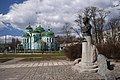 Monument and Assumption Cathedral
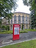 Agricultural school
 District administration
 Former women's gymnasium
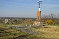 Holocaust monument near Zolotonosha


Notes
References
- 1 2 Чисельність наявного населення України на 1 січня 2022 [Number of Present Population of Ukraine, as of January 1, 2022] (PDF) (in Ukrainian and English). Kyiv: State Statistics Service of Ukraine. Archived (PDF) from the original on 4 July 2022.
- ↑ "Золотоніська територіальна громада" (in Ukrainian). decentralization.gov.ua.
- ↑ "Про утворення та ліквідацію районів. Постанова Верховної Ради України № 807-ІХ". Голос України (in Ukrainian). 18 July 2020. Retrieved 3 October 2020.
- ↑ "Нові райони: карти + склад" (in Ukrainian). Міністерство розвитку громад та територій України.
- 1 2 3 4 "Zolotonosha index". KehilaLinks. Retrieved 13 February 2021.
- 1 2 3 4 5 Słownik geograficzny Królestwa Polskiego i innych krajów słowiańskich (in Polish). Vol. XIV. Warszawa. 1895. pp. 659–660.
{{cite book}}: CS1 maint: location missing publisher (link) - 1 2 3 4 Енциклопедія українознавства. Словникова частина (ЕУ-II). Vol. 3. 1994. pp. 840–842.
- 1 2 3 "Zolotonosha". Yad Vashem.
- ↑ С. Хургін (1922). Адміністраційна Мапа Української Соц. Рад. Республіки (Map). 1:1,680,000 (in Ukrainian). Kharkiv: Народний комісаріат внутрішніх справ.
- ↑ С. Я. Хургин (1921). Карта Украинской Социалистической Советской Республики (Map). 1:1,680,000 (in Russian). Народный комиссариат внутренних дел.
- ↑ Административная карта Украины (Map). 1:1,050,000 (in Russian). Народный комиссариат внутренних дел. 1923.
- ↑ "Рідні мови в об'єднаних територіальних громадах України" (in Ukrainian).
- ↑ "World Meteorological Organization Climate Normals for 1991-2020 — Zolotonosha". National Oceanic and Atmospheric Administration. Archived from the original on 22 April 2025. Retrieved 16 June 2024.
External links
- The murder of the Jews of Zolotonosha during World War II, at Yad Vashem website.
- (in Ukrainian) (1972) Історіа міст і сіл Української CCP - Черкаська область (History of Towns and Villages of the Ukrainian SSR - Cherkasy Oblast), Kyiv.
 Media related to Zolotonosha at Wikimedia Commons


| International | |
|---|---|
| National | |
| Geographic | |
| Other | |

