English: Linguistic maps. Maps showing the distribution of languages in a region.
Català: Mapes lingüístics.
Subcategories
This category has the following 22 subcategories, out of 22 total.
Pages in category "Linguistic maps"
This category contains only the following page.
Media in category "Linguistic maps"
The following 50 files are in this category, out of 50 total.
-
 Adi Speakers Map.jpg 564 × 581; 53 KB
-
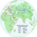
 African languages and their place of origin - Christopher Ehret.jpg 646 × 800; 108 KB
-
 Aire Ouest Berceau (+ Berce).png 298 × 197; 81 KB
-
 Alternative neo-native language of Iran.jpg 2,598 × 2,598; 724 KB
-
 Alveolar vs. uvular r in Hessian dialects.png 599 × 737; 182 KB
-
 Bengali dialects.png 5,310 × 4,479; 3.24 MB
-
 Bengali dialects2.png 5,310 × 4,479; 2.73 MB
-
 Burmese Speaking World Map 20250125015808.png 2,580 × 1,551; 1.58 MB
-
 CamelWanderwörter.png 4,096 × 4,096; 1.67 MB
-
 Chibchan languages map.svg 1,122 × 794; 167 KB
-
 Comuni e valli ladine.png 3,784 × 3,625; 1.04 MB
-
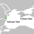 Crimean Tatar and Dobrujan Tatar.png 382 × 382; 48 KB
-
 Deuri language.png 1,261 × 904; 181 KB
-
 Dhakaiya Kutti Bengali map.png 5,070 × 5,031; 1.98 MB
-
 Distribuição falantes coreano.png 4,000 × 4,000; 479 KB
-
 Divisions territoriales ayant une ou plusieurs langues officielles en plus du russe.png 6,576 × 3,990; 2.69 MB
-
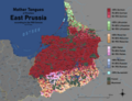 East Prussia Ethnic Map 1905.png 11,338 × 9,522; 76.98 MB
-
 Francosign Languages of North America.svg 512 × 533; 158 KB
-
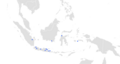 Indonesian Arabic map.png 3,264 × 1,733; 281 KB
-
 Jasinga-Sundanese-Map.jpg 4,096 × 2,052; 209 KB
-
 Kaart van etnische en taalkundige verspreiding op de Flores-eilanden.png 3,264 × 3,060; 842 KB
-
 Language Map of Uttar Pradesh (2011 Census).svg 1,073 × 1,046; 567 KB
-
 LanguageMap-Swahili-Kibembe-kifuliru-Kivira-Kirundi-Large Location.jpg 971 × 1,080; 166 KB
-
 Langues indochine.jpg 821 × 1,730; 534 KB
-
 Langues mongoles.jpg 1,140 × 754; 420 KB
-
 Linguistic Map of Hainan.svg 512 × 384; 261 KB
-
 Low Saxon Competence by district 2016.svg 946 × 592; 549 KB
-
 Lushootseed area.png 2,095 × 2,159; 958 KB
-
 Map of Lamalera ethnic-speakers on Lembata Island (Indonesia).png 3,264 × 1,896; 166 KB
-
 Map of Mahasuic group of languages.jpg 650 × 846; 291 KB
-
 Map of the Distribution of Urdu-Speaking Bihari Communities in Bangladesh.png 2,237 × 3,086; 923 KB
-
 Maybe Indo-European Altaic Uralic Basque and Maltese languages map.png 7,030 × 3,542; 3.68 MB
-
 Mpi language map.png 1,038 × 845; 1.43 MB
-
 Mymensinghi language 20250312164537.png 5,269 × 3,921; 897 KB
-
 Origin of Afroasiatic (Egyptian Red Sea model 2009) and Semitic.jpg 462 × 589; 170 KB
-
 Peta Bahasa di Serang Raya.jpg 2,364 × 3,481; 377 KB
-
 Peta wilayah penggunaan bahasa Sunda di Kota Depok.jpg 4,096 × 2,894; 457 KB
-
 Rangpuri Language Map 20250130004835.png 3,453 × 2,665; 608 KB
-
 Rough Map of German speaking countries and partitions.png 2,048 × 1,360; 92 KB
-
 Sicilian Dialects.png 7,350 × 4,993; 2.04 MB
-
 Sign Languages of Turtle Island.svg 512 × 533; 164 KB
-
 Tegal Javanese.png 2,901 × 3,264; 1.18 MB
-
 The legal recognition of national signed languages.jpg 1,414 × 1,289; 220 KB
-
 Tiipay Speakers Geography.png 224 × 195; 8 KB
-
 Toponimia de las entidades federativas de mexico.jpg 2,481 × 1,749; 997 KB
-
 Uralilaisen kielikunnan kartta suomeksi (Sukukansojen ystavat ry).pdf 1,510 × 1,018; 4.16 MB
-
 Wari' - distribuição aproximada.svg 1,039 × 678; 102 KB
-
 Карта хакасских (Сибирских) тюркских языков.png 2,300 × 1,850; 459 KB
-
 বাংলার উপভাষাসমূহ ২.png 5,310 × 4,479; 2.1 MB
-
 বাংলার উপভাষাসমূহ.png 5,310 × 4,479; 2.62 MB


